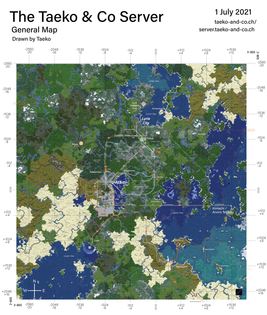
Historic Taeko & Co Maps
As long as the server has existed, we’ve been mapping it. Since April 2020, the server has grown significantly, and the best way of seeing it is through the maps.
Here is a collection of every released and unreleased Taeko & Co Server Map.
September 2020
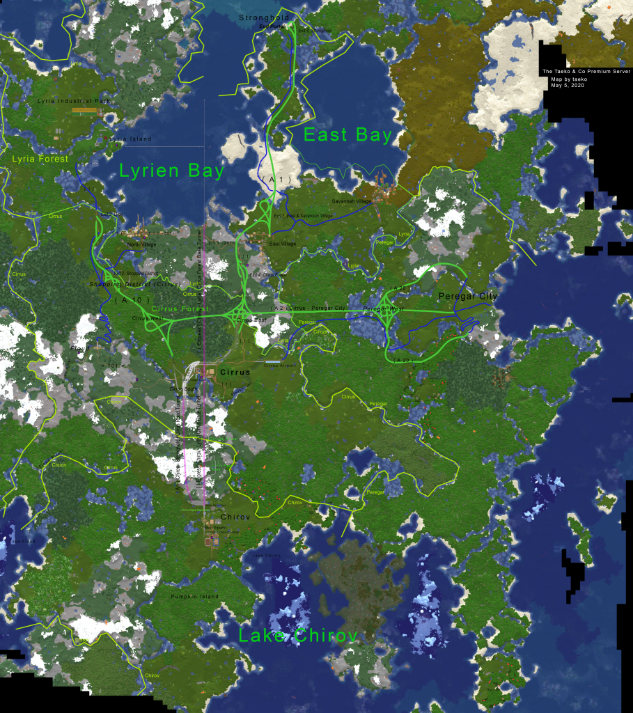
October 2020
Gap 2020/2021
Between October 2020 and April 2021 there is a gap, where I was not online for a while.
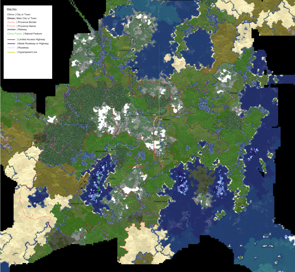
19 September 2021
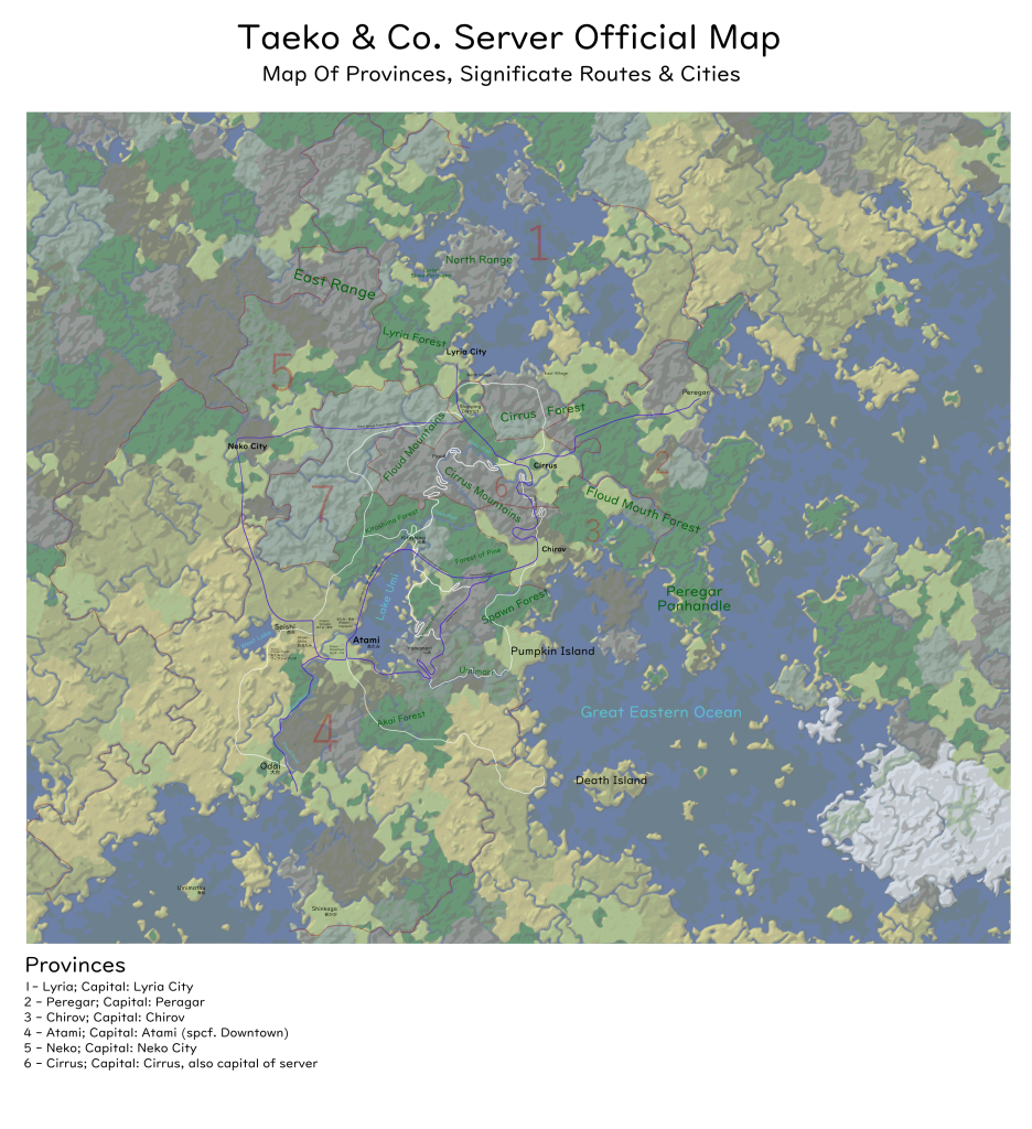
September 2021 – Present
In Mid-September 2021, we began experimenting with BlueMap and later Dynmap. While BlueMap was extremely detailed and featured impressive mapping abilites, it utimately ran too slowly, which lead us to implement Dynmap, the mod we still use today for the current, live map.
However, due to the recently formed City Council of Wengen (Wengener Stadtrat), drawn maps may become necessary again to accurately label streets and areas in the city. Detailed maps, like those on this page, will no longer be possible, because the country has grown so much in size. A possibility would be to divide the country into 4×4, so 16 theoretically different maps. Of course Atteca is much taller than it is wide, so only around 10 or so would be required.